الفن المعماري للاجهزة المساحية

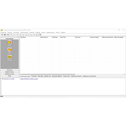
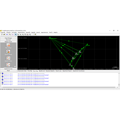
GEOSolution is a software for post processing static or kinematic (also known as stop and go) data. It provides an efficient way for calculating vectors, network adjustment and resultant positions by using GPS, GLONASS, GALILEO and Beidou with single or double frequency. You can get things done easily with the compact and step-by-step interface.
GeoSolution is a software for post processing static or kinematic (also known as stop and go) data. It provides an efficient way for calculating vectors, network adjustment and resultant positions by using GPS, GLONASS, GALILEO and Beidou with single or double frequency. You can get things done easily with the compact and step-by-step interface.
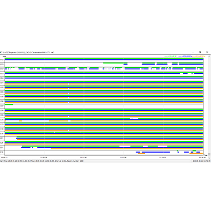
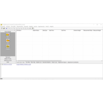
Observation data: View/Edit observation files
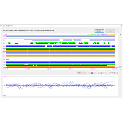
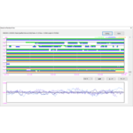
Time Map: View observation period, double click on time line to see satellite quality details
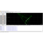
Plane Map: View observation stations plane map
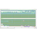
Baseline List: View/Edit baseline information
Repeated Baseline: Double click to view repeated baseline detail
Close loop: Double click to view close loop detail
Adjustment Report: View adjustment report
Adjustment Coordinates: View coordinate result
Based on the Android platform, SurPad 4.2 is designed for assisting professionals to work efficiently for all types of land surveying and road engineering projects in the field. Combining with the international mainstream of surveying and mapping data acquisition function, it integrates with professional receiver control, point collection, stakeout, GIS data collection, road measurement, road design, cross section measurement and railway stakeout.
Windows – VRS Management Software
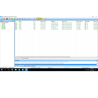
GNSS.NET is the software to combine multiple base stations as a network providing VRS service. It includes functions such as station management, user management, physical base station data transmission, VRS service, coordinate system transmission
MicroSurvey FieldGenius was designed for Land Surveying, Civil Engineering, Seismic Surveying, and Construction Staking professionals to provide unequalled data collection simplicity and field calculating performance
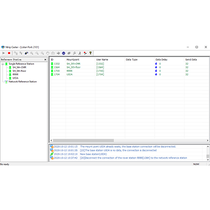
NTRIPCaster provides network solution for your survey job. Build your own NTRIP server to enjoy the safe and stable connection.
MicroSurvey FieldGenius was designed for Land Surveying, Civil Engineering, Seismic Surveying, and Construction Staking professionals to provide unequalled data collection simplicity and field calculating performance