
-
eME30
3D GNSS EXCAVATOR GUIDANCE SYSTEM
The eSurvey eME30 is designed with high accuracy and consumes less time by guiding excavator operations. It employs GNSS RTK technology to obtain the bucket’s real-time and accurate 3D position information by reading multiple tilt sensors installed on the excavator. The eME30 features intuitive, easy-to-learn software that runs on the Android operating system. The state-of-the-art hardware and software help operators of all skill levels work faster and more efficiently than ever, especially in complex environments. To sum up, you can accomplish more in less time.
-
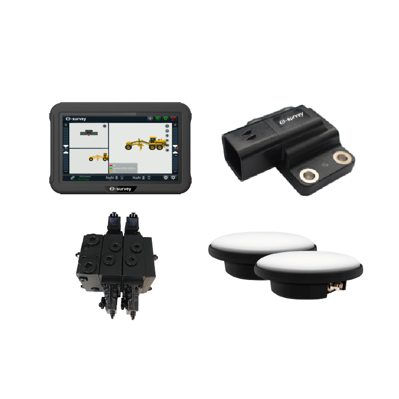
eMG30
3D AUTOMATIC CONTROL SYSTEM FOR MOTOR GRADERS
The eMG30 system improve the construction quality and efficiency of earth moving engineering. The system adopts GNSS RTK high-precision positioning technology, IMU, and hydraulic control technology to calculate the three-dimensional coordinates of the grader blade in real time. And, according to the three-dimensional design drawings on the vehicle tablet, the blade attitude is controlled in real time, with absolute elevation accuracy of centimeters.
-
eMP10
INTELLIGENT PILING GUIDANCE SYSTEM
The eMP10 system adopts multi-satellite system high-precision real-time positioning and orientation, as well as multi-sensor fusion technology, to obtain accurate three-dimensional position information of the pile head; Collect real-time data from sensors installed on the pile foundation, such as current sensors and grout volume sensors; Able to capture digital and image files to assist the machine operators in precise construction.
-
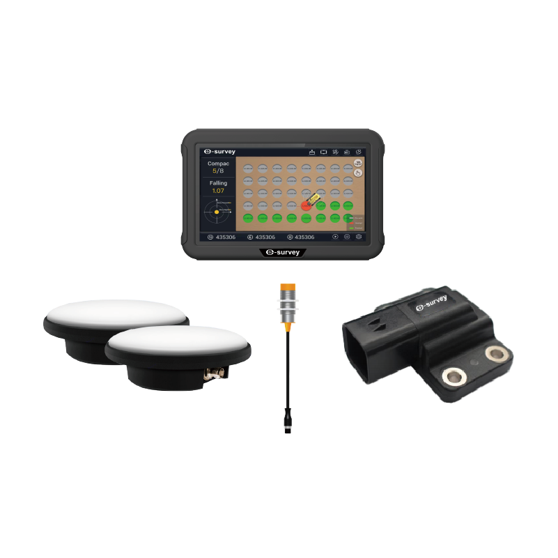
eMR10
GNSS INTELLIGENT ROAD ROLLER SYSTEM
The eSurvey eMR10 intelligent road roller compaction system adopts high-precision Beidou positioning, compaction sensor and temperature sensor technology. The eMR10 digitally and graphically displays and records the construction process data in real time, collects and monitors the speed and trajectory of vehicle travel, compaction value, vibration status, milling temperature and other key parameters. The data is transmitted back to the synchronized digital construction management platform in real time to generate customized reports, ensuring the construction quality of rolling. The eMR10 is widely used for earth and stone layered filling, subgrade, and surface grinding on a variety of projects, including railroads, highways, dams, and harbors.
-
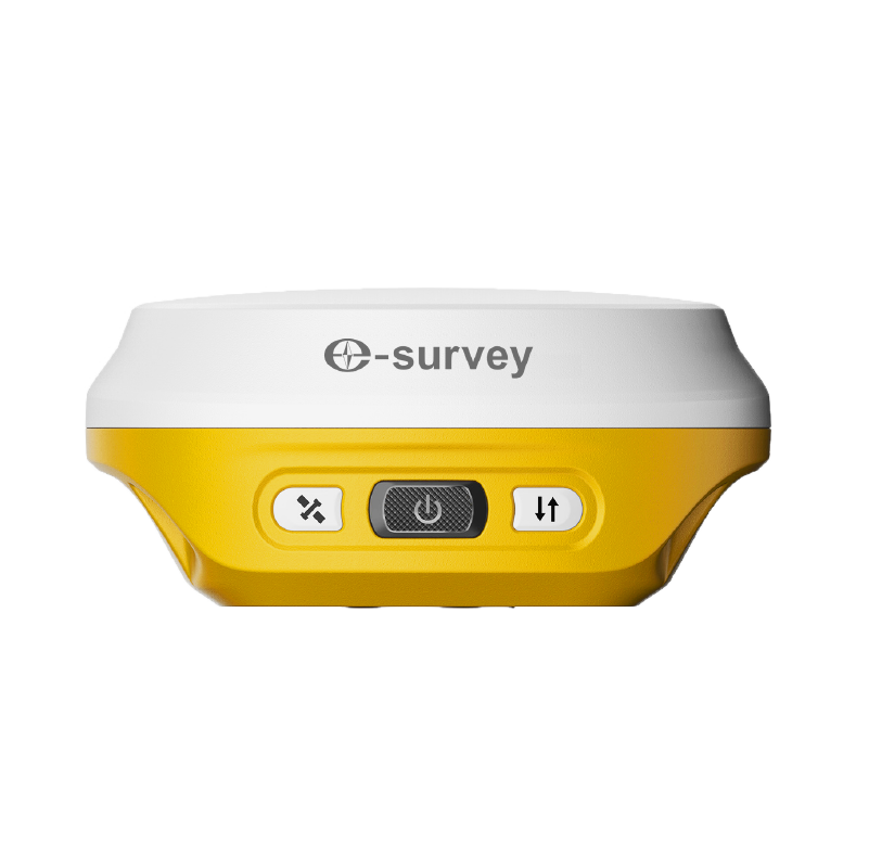
eRTK10
AR VISUAL STAKEOUT GNSS RECEIVER
The eSurvey eRTK10 is a brand new GNSS receiver integrated with visual technology by eSurvey GNSS. It supports immersive 3D stakeout under real working environment. With the AR visual positioning technology, the eRTK10 helps you do stakeout faster and improves your working efficiency. The compact design makes it easy to carry around in various complex environments. Integrated with internal radio (Rx only) and 60° inclination IMU function, the eRTK10 is a perfect choice for any rover station scenarios.
-
eRTK10 mini
POCKET-SIZE GNSS RECEIVER
The eSurvey eRTK10 mini is a pocket-size IMU-based GNSS receiver equipped with a high-performance and high-precision GNSS module. It integrates IMU tilt technology for efficient staking out, features a compact and lightweight design for easy portability, and serves as an ideal high-precision GNSS positioning sensor for seamless integration into various industry application solutions.
-
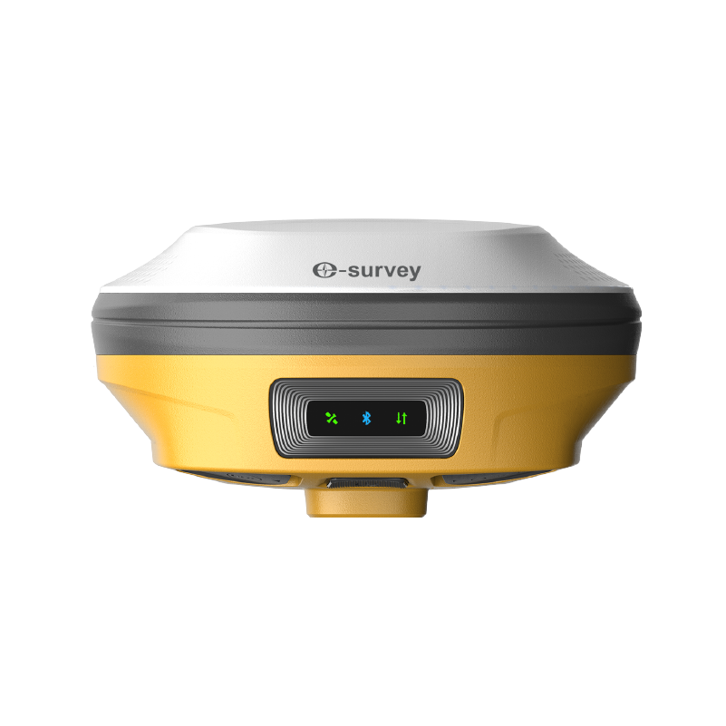
eRTK20
VISUAL STAKEOUT GNSS RECEIVER
The eSurvey eRTK20 GNSS receiver combines GNSS, IMU, wide-angle dual cameras, and a compact design to dramatically improve surveying efficiency. The CAD AR visual stakeout can increase project stakeout efficiency by 40%. With inbuilt radio (Tx and Rx) and a 60° inclination IMU function, the eRTK20 is ideal for any survey scenario.
-
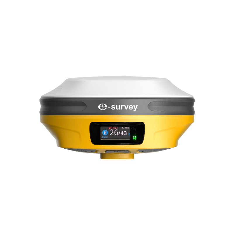
eRTK30
VISUAL GNSS RECEIVER WITH DUAL-CAMERA TECHNOLOGY
The eSurvey eRTK30 GNSS receiver integrates with dual-camera technology for more applications. Its visual survey technology enables you to measure the point without physically reaching the point. That gives you flexibility in the field and maximises productivity in your projects. It supports immersive 3D stakeout and helps you do stakeout faster and improves your working efficiency. The eRTK30 is a perfect choice for diverse surveying applications.
-
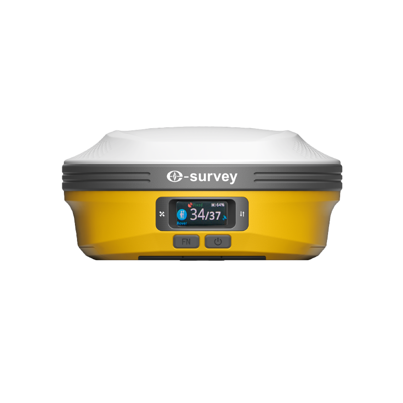
eRTK60
FULL-FEATURED VISUAL GNSS RECEIVER
The eSurvey new eRTK60 GNSS receiver integrates high performance GNSS, IMU and dual-camera technologies to provide more reliable and diverse measurement results. Visual survey technology enables you to measure the point without physically reaching it, thereby giving you more flexibility in the field and maximizing productivity in your projects. The upgraded built-in radio supports longer communication distances. The extended working endurance of the eRTK60 is guaranteed by its hot-swap batteries. Its colorful LED screen also offers a more intuitive working status and operation interface.
-
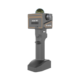
eScan M1
ANYWHERE YOU GO
The combination of zero-processing algorithms and anti-fuzzy technology balances speed and accuracy. Industry-leading portability, breaking through the traditional device bulky limitations. With “high efficiency, precision, lightweight and openness” as the core, it offers an optimal user experience from data collection to application landin
-
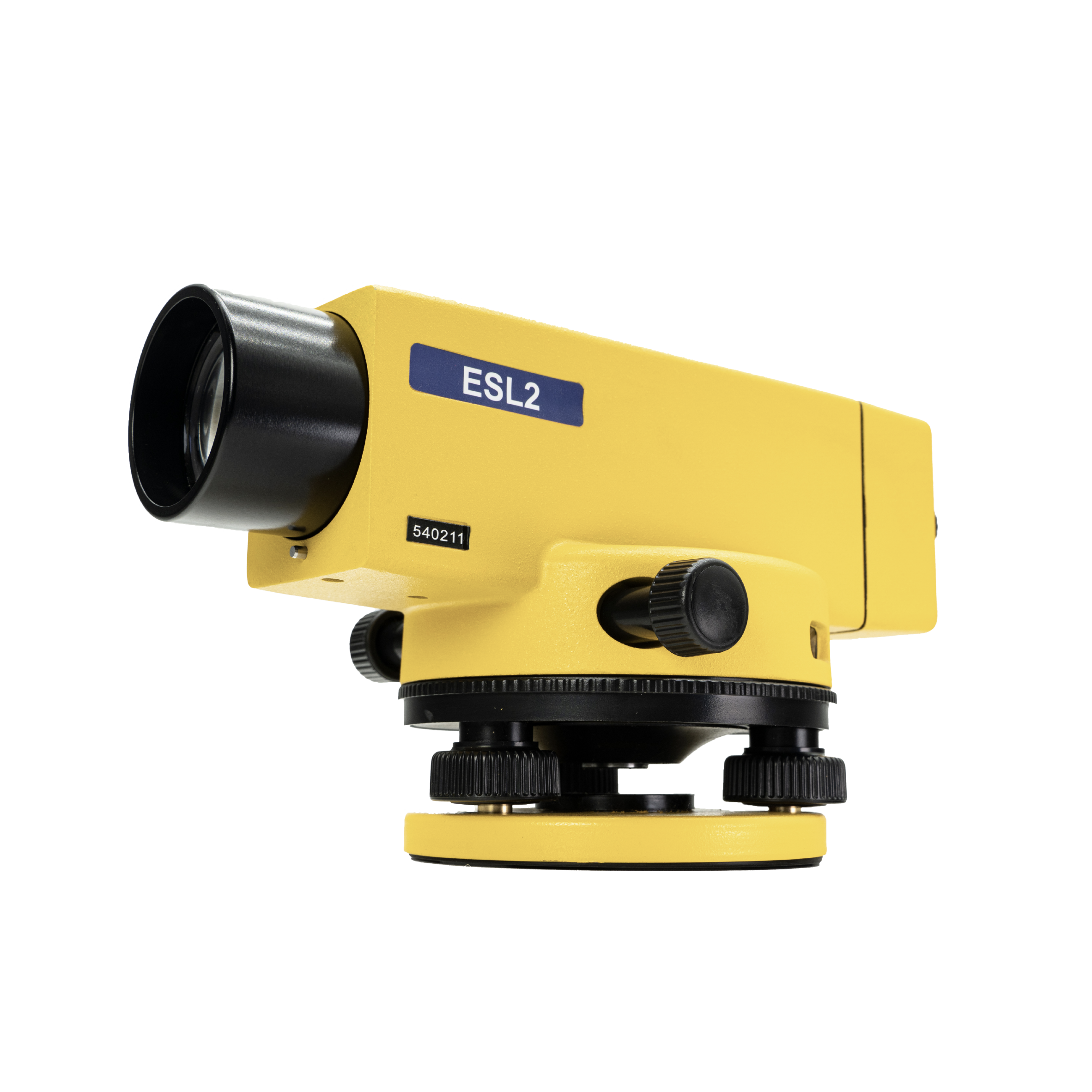
ESL2
PRECISE AUTOMATIC LEVEL
The eSurvey ESL2 is suitable for geodetic control, construction of roads, and industrial applications. The ESL2 with ESM1 can supply higher accuracy and work to monitor structural deformations. The use of an automatic compensator speeds up work and improves accuracy. ESL2 operates in the range of temperatures from -30°C to +50°C.
-
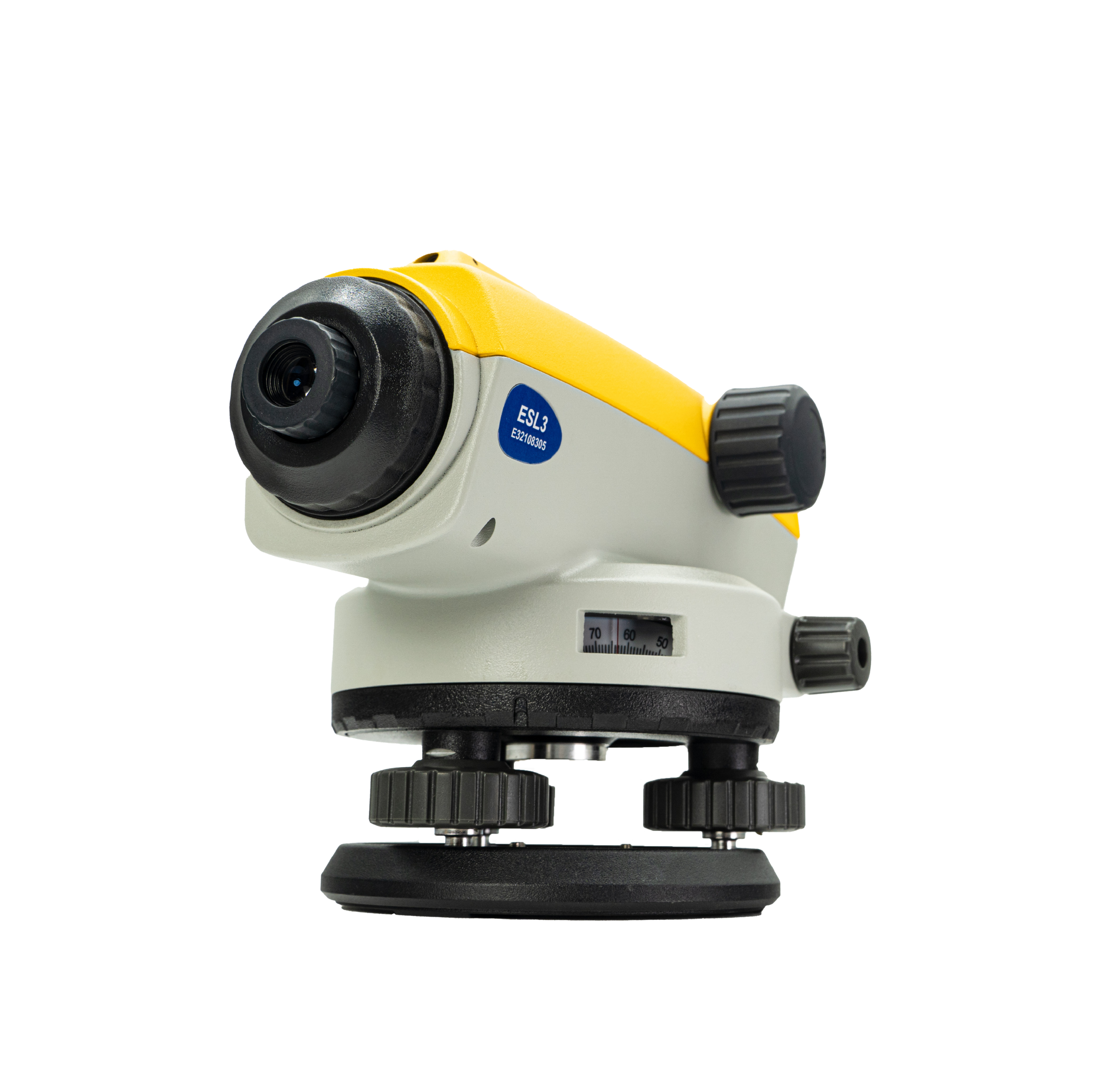
ESL3
AUTO LEVEL
The ESL3 is equipped with a magnetic damping compensation system which has a large compensation range and a high compensation accuracy compensator to ensure the equipment accuracy and measurement efficiency even in a complex environment subject to vibration or shock. 32x magnification, 38mm large clear aperture equipped with 550nm coating ensuring fast and smooth measurement. The all-metal body and IP66 design ensure the ESL3’s strong environmental adaptability.
-
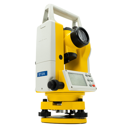
ET2A
PRECISE ELECTRONIC THEODOLITE
The ET2A is a high-precision electronic theodolite. This device has 2″ angle measurement accuracy and a 30x magnification effect to meet various working requirements.
-
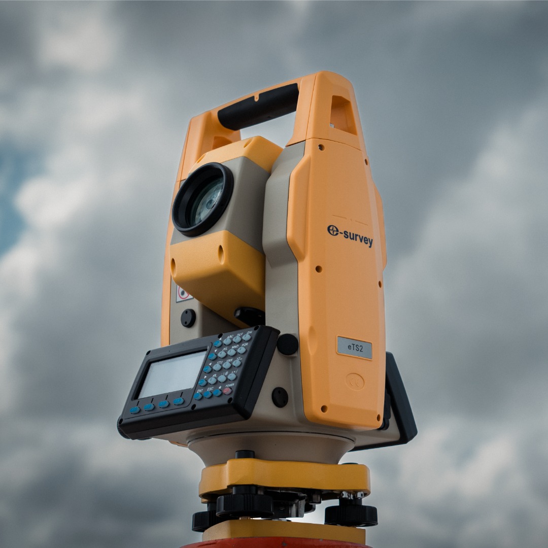
eTS2
HIGH-EFFICIENCY OPERATION TOTAL STATION
The eSurvey eTS2 is a high-precision manual total station with a better measurement range. The eTS2 can import and export data through a USB disk more efficiently, thanks to its standard USB flash disk interface. With a complete design, ensure efficient measurement.
-
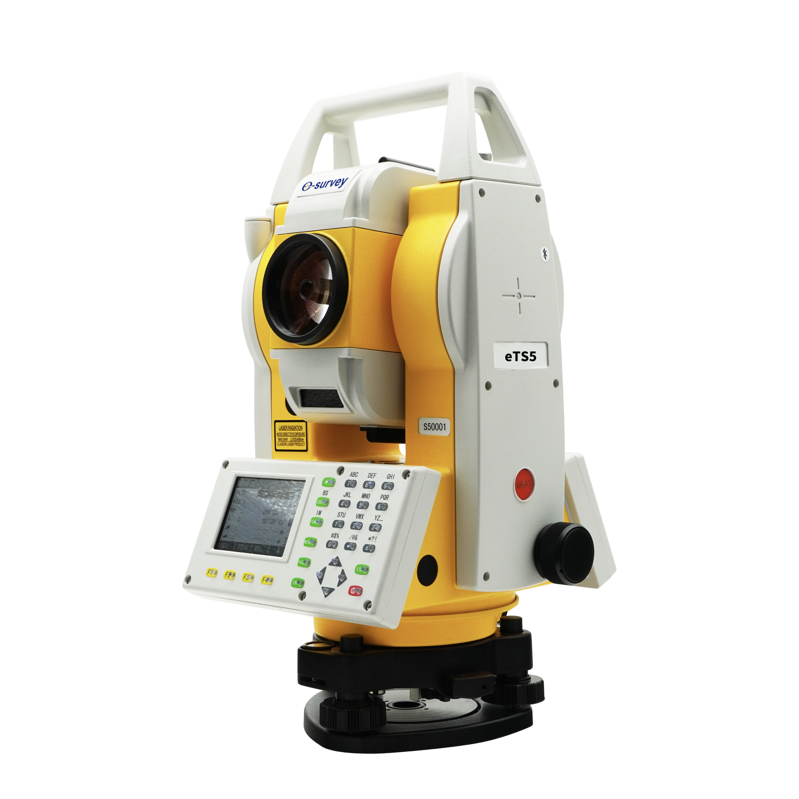
eTS5
HIGH PRECISE TOTAL STATION
The eSurvey eTS5 is a high-precision manual total station, with 2″ angle measurement accuracy that meets most survey and stakeout tasks. With Dual QVGA color screens and friction screws, the USB interface makes measurement more efficient. The 3400 mAh battery works continuously for long hours. LED-backlight alphanumerical keyboard makes it possible to operate correctly in the dark.
-
eTS8
ANDROID SMART TOTAL STATION
The eSurvey eTS8 is a high precision manual total station, with accurate angle and distance measurement. It can work reliably and deliver good results even in harsh environments. And its simple operations make most survey and stakeout tasks more efficiently.