

-
Bestar 301
MULTI-FUNCTIONAL AUTO-STEERING SYSTEM
Independently developed by eSurvey GNSS, the eSurvey Bestar 301 is a multi-functional electric wheel-based auto-steering system. The Bestar 301 could transfer farm work from fully manual driving to semi-automatic operation. It means high time efficiency and less operator fatigue. Based on the route planning algorithm, the vehicle could go through the same paths every time to seed, spray and harvest with ±2.5 cm accuracy, which increases crop yield and reduces chemical usage.
-
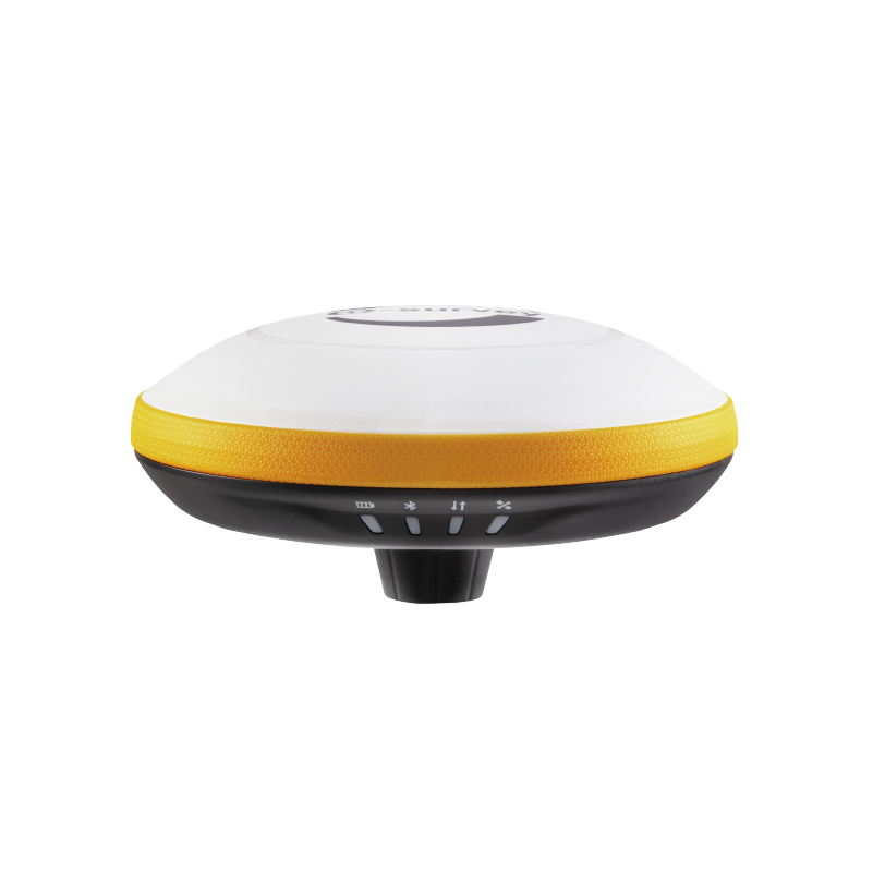
E200
DESIGNED FOR ROVER STATION
Gain a competitive edge with the eSurvey E200 GNSS Receiver. The E200 is equipped with advanced technology to make sure you have maximum productivity in the field. The durable IP67 design makes it possible to work in tough environments. Combining 4G GSM modem, internal radio (Rx only), RTK Aid function and 60° inclination IMU function, the E200 is the best choice for a rover station receiver.
-
E3
SIMPLE OPERATION TOTAL STATION
The eSurvey E3 is a high-precision manual total station, with accurate angle and distance measurement. It works reliably and delivers precise results even in harsh environments. And its simple operations make most survey and stakeout tasks more efficiently.
-
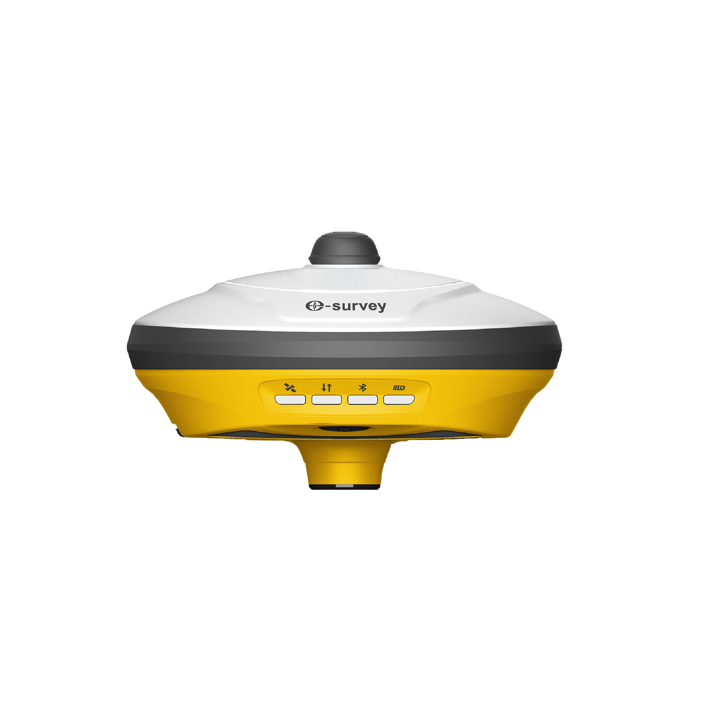
E300 Pro
FULL-FEATURED GNSS RECEIVER
The eSurvey E300 Pro is a fully functional GNSS receiver with an extremely compact design by eSurvey GNSS. With its high-performance GNSS board, it can track all present constellations and satellites. The GNSS, Wi-Fi, Bluetooth, and GSM four-in-one antenna, stable data transmission, RTK Aid, and IMU function, make it suitable for all surveying applications.
-
E600
Powerful, full-featured RTK receiver
The E600 is an innovative product from eSurvey GNSS. Its rugged IP67 design enables operation in a variety of environments. Multi-star constellation and frequency tracking provide a stable solution for your work. Thanks to its dual, swappable batteries, it can operate continuously for all-day operation.
-
E800
HIGH-PERFORMANCE GNSS RECEIVER
The E800 is a high-performance GNSS receiver that provides an easy-to-use solution for survey professionals who need to collect highly accurate data in a wide range of applications. The durable IP67 design makes it possible to work in extreme environments. The colorful touchscreen is convenient for quick configurations.
-
EAS100
AUTO-STEERING SYSTEM FOR PRECISION AGRICULTURE
The EAS100 is an eSurvey new generation electric wheel-based auto-steering system. The eSurvey EAS100 helps to transfer farm work from fully manual driving to semi-automatic operation. It means high time efficiency and less operator fatigue. Based on the route planning algorithm, the vehicle could go through the same paths every time to seed, spray and harvest with ±2.5 cm accuracy, which increases crop yield and reduces chemical usage.
-
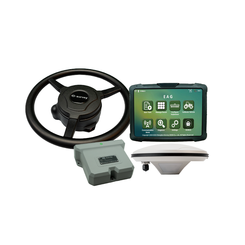
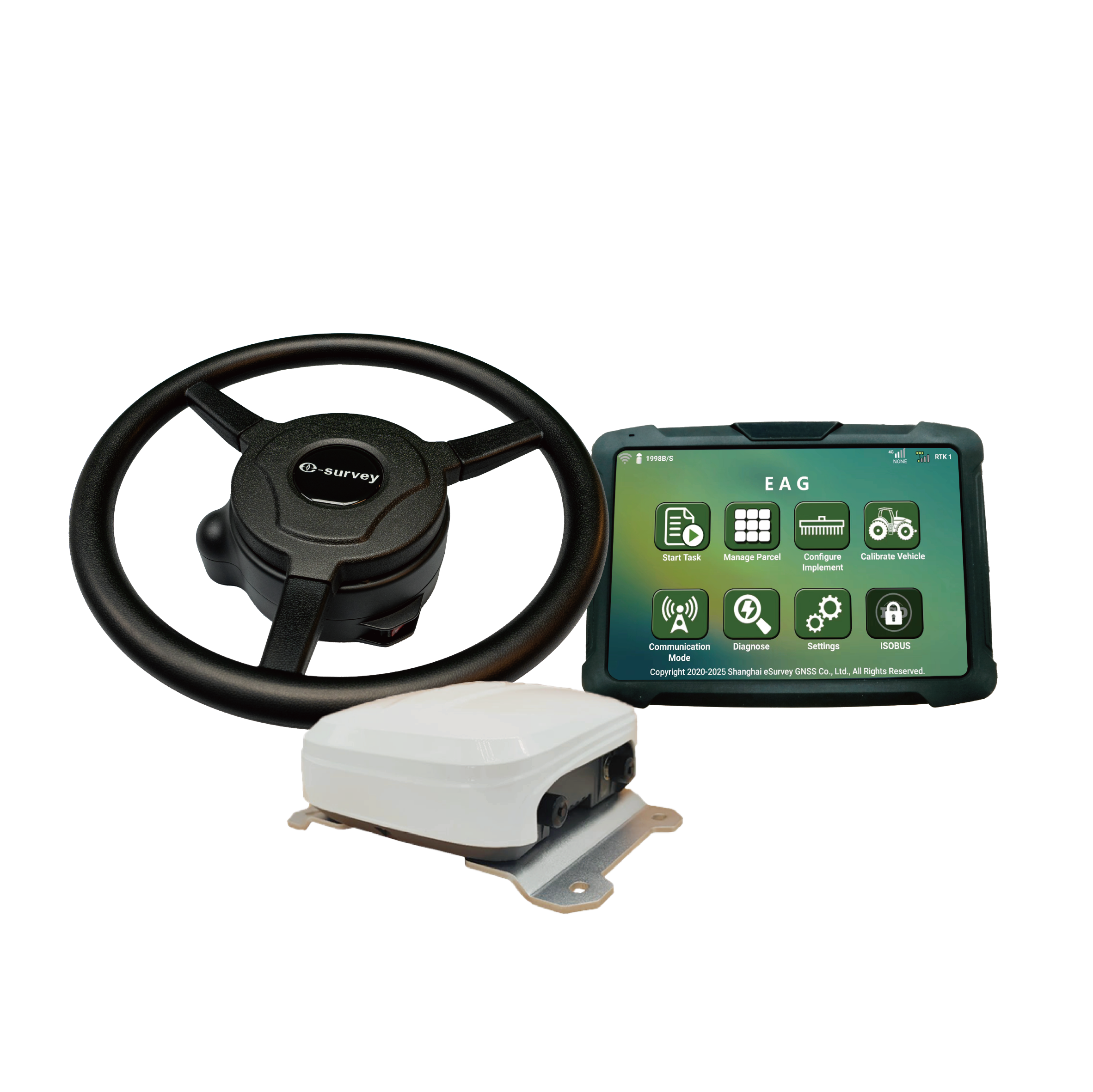
EAS301 Pro Electric Wheel
MULTI-FUNCTIONAL AUTO-STEERING SYSTEM
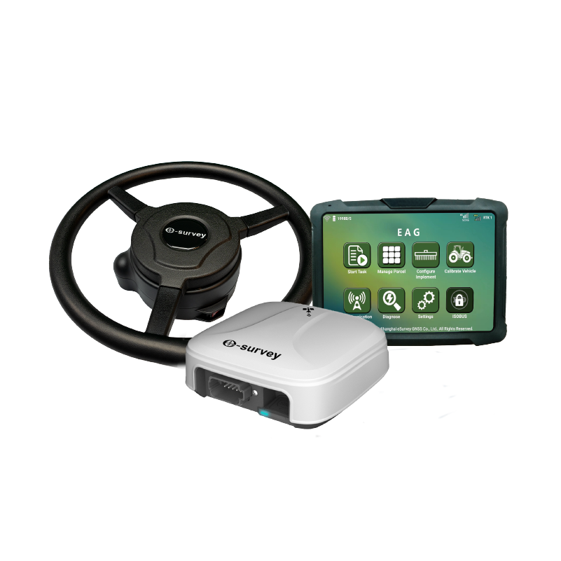
Independently developed by eSurvey GNSS, the eSurvey EAS301 Pro is a multi-functional electric wheel-based auto-steering system. The EAS301 Pro could transfer farm work from fully manual driving to semi-automatic operation. It means high time efficiency and less operator fatigue. Based on the route planning algorithm, the vehicle could go through the same paths every time to seed, spray and harvest with ±2.5 cm accuracy, which increases crop yield and reduces chemical usage.
-
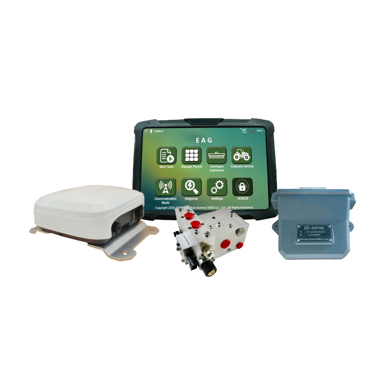
EAS301 Pro Hydraulic
HYDRAULIC AUTO-STEERING SYSTEM
The eSurvey EAS301 Pro is an eSurvey hydraulic retrofit auto-steering kit. The EAS301 Pro noticeably improves the operation efficiency of agricultural machinery by the centimeter-level accuracy of repeated farming operations and 24-hour uninterrupted work even in the day with heavy UV lights or at night. It also reduces the labor intensity of drivers and increases the unit output.
-
eBase 20
PORTABLE GNSS BASE RECEIVER
The eSurvey eBase 20 is a professional and portable GNSS base receiver. With a high-precision GNSS module and tracking multiple frequencies, eBase 20 is specifically designed to work as a GNSS base station. Combining a 4G modem and internal radio, eBase 20 is a perfect choice for a base station. The eSurvey eBase 20 is ideal for applications such as UAV, USV, agriculture, intelligent driving, surveying and mapping, etc.
-
eDMR1
INTEGRATED GNSS MONITORING RECEIVER
Independently designed and developed by eSurvey GNSS, the eSurvey eDMR1 features high stability, high reliability, and simple operation. It solves the problems of high cost and high deployment consumption of traditional GNSS monitoring equipment. It can be applied to monitoring the displacement and deformation of geological disasters and reservoir dams, etc., and provide all-weather high-quality monitoring results. The eDMR1 can collect data by simultaneously connecting to multiple sensors, like rainfall sensor, water level sensor, seepage, seepage pressure sensor, camera, etc., and transmit all collected data. It owns strong edge computing capability and supports local front-end static solutions. Benefiting from the built-in warning model based on multi-parameter calculation and analysis, it can realize front-end multi-parameter intelligent calculation, analysis, and warning forecast in situations, like extreme weather, no public network, etc.
-
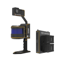
eHLS2
HANDHELD LIDAR SCANNER
The eSurvey eHLS2 is a new portable handheld LiDAR scanner designed and manufactured by eSurvey GNSS experts. It is flexible and easy to operate. Powered by an industry-leading SLAM algorithm, eHLS2 can acquire point cloud data for both indoors and outdoors with high accuracy. High-definition colorized point cloud can also be acquired with the external camera. With an optional GNSS module, eHLS2 acquires a more accurate point cloud integrated with GNSS location.
-
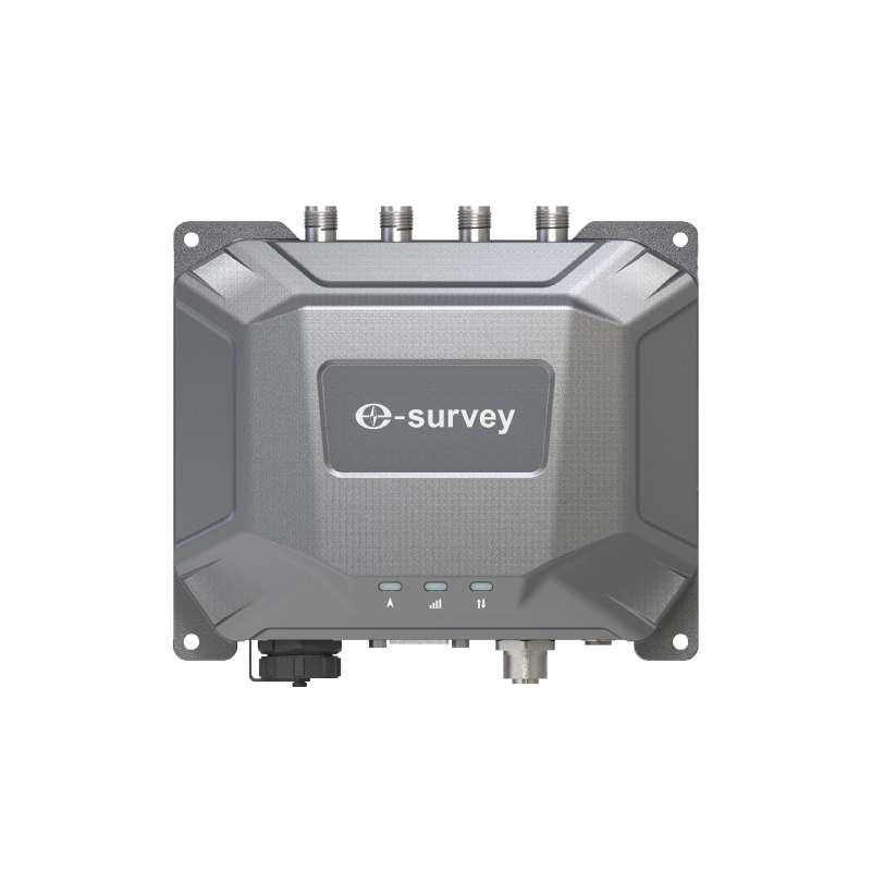
eHP10
INDUSTRY DESIGN HEADING AND NAVIGATION GNSS RECEIVER
As a heading GNSS receiver, the eHP10 integrates dual-antenna, TX/RX radio, lora, serial port and 4G network, with a variety of working modes, suitable for Machine control, Marine survey, Geodesy and other industries.Due to its unique interface and internal design, the eHP10 greatly improves the waterproof and shock resistance performance, and can work stably in a variety of environments.
-
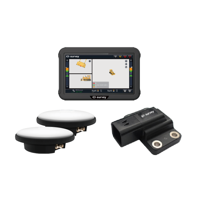
eMB10
3D GNSS GUIDANCE SYSTEM FOR BULLDOZERS
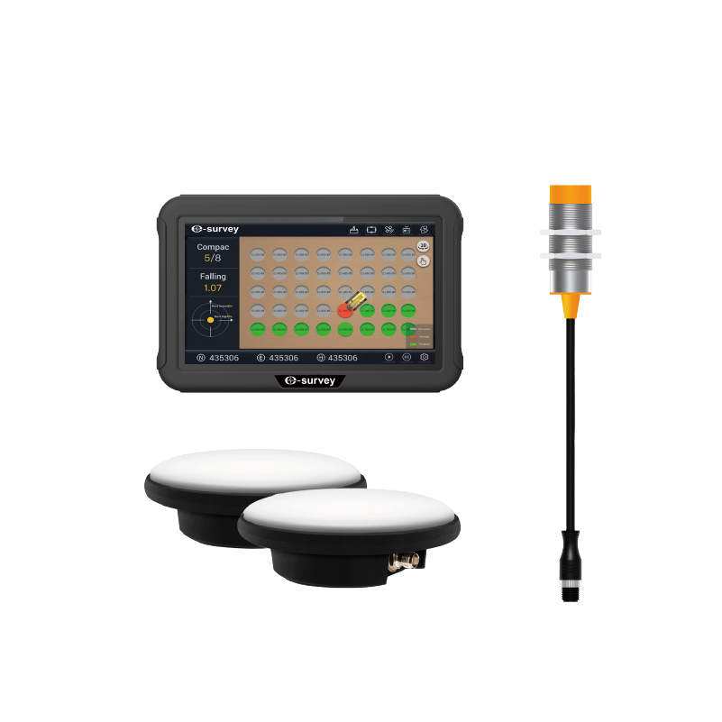
The eMB10 integrates multi-constellation precision positioning, sensor fusion, and real-time 3D guidance for bulldozer blade guidance or control. Using 3D data as a reference, the system rapidly meets design specs without traditional surveying. The system enables round-the-clock operation by any operator, hence ensuring speedy and accurate task completion, reducing rework, and enhancing productivity and project profits.
-
eMC10
3D GNSS CRANE GUIDANCE SYSTEM
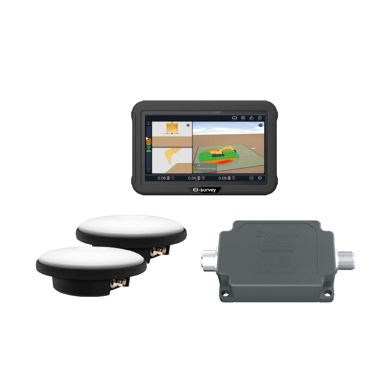
The eSurvey eMC10 Crane Intelligence System integrates multi-constellation precise positioning with real-time 3D guidance via sensor fusion, accurately tracking the crane hook’s coordinates in real time. Using coordinate files as design blueprints, it swiftly meets design specifications, bypassing conventional surveying. It allows the operator to complete tasks quickly and precisely, reduces rework, increases productivity, and raises project profitability.
-
eME10
3D GNSS EXCAVATOR GUIDANCE SYSTEM
The eSurvey eME10 is designed with high accuracy in mind and consumes less time by guiding excavator operations. It employs GNSS real-time dynamic positioning technology to obtain the bucket’s real-time and accurate 3D position information by reading multiple tilt sensors installed on the excavator. The eME10 features intuitive, easy-to-learn software that runs on the Android operating system. The state-of-the-art hardware and software help operators of all skill levels work faster and more efficiently than before, particularly in complicated environments. To summarize, you can accomplish more in less time.