


SurPad4.2
Android – Field Data Collection Software
Based on the Android platform, SurPad 4.2 is designed for assisting professionals to work efficiently for all types of land surveying and road engineering projects in the field. Combining with the international mainstream of surveying and mapping data acquisition function, it integrates with professional receiver control, point collection, stakeout, GIS data collection, road measurement, road design, cross section measurement and railway stakeout.
Powerful functions
Enjoy the powerful functions, including tilt survey, CAD, line stakeout, road stakeout, GIS data collection, COGO calculation, QR code scanning, FTP transmission, etc.
Easy-to-use UI
Freely choose the desired display style, including list, grid and customized style, and enjoy easy operations with graphic interaction, including COGO calculation, QR code scanning, FTP transmission, etc.
Compatible with any Android devices
Use it in all Android devices, including eSurvey handhelds, Android phones, tablets and other third-party Android devices.
Abundant import and export formats
Directly import and export files with frequently used formats and customized formats.
|
Basic Information |
|
|
Platform |
Android |
|
Update |
Online
update |
|
Activation |
Online
activation |
|
Communication |
|
|
Bluetooth |
Support |
|
Wi-Fi |
Support |
|
Serial
port |
Support |
|
Simulation |
Support
customized coordinate |
|
Map Function |
|
|
Online |
Google street map1 Google satellite map1 Open street map |
|
Offline |
SHP, DXF, DWG, XML |
|
Coordinate System |
|
|
Predefined |
Large number of coordinate systems |
|
Localization |
Four parameters, seven
parameters |
|
Geoid
files |
GGF, SGF, UGF, customized
EDS |
|
Grid files |
GSB, customized GDS |
|
Sharing function |
Share with QR code or save
locally |
|
RTCM1021~1027 |
Support |
|
Grid to ground |
Support |
|
|
|
|
Import & Export |
|
|
Export |
CSV, DAT, DXF, KML, GPX, HTML… |
|
Import |
CSV, DAT, TXT, DXF, KML… |
|
|
|
|
Survey Mode |
|
|
Point type |
Topo point Control point Quick point Auto point by time/distance Corner point Tilt point Stop and go |
|
CAD entity |
Line, polyline, rectangle, polygon,
circle, arc, spline |
|
GIS Function |
Support |
|
|
|
|
CAD Function |
|
|
CAD format |
DXF, DWG, XML |
|
CAD drawing |
Support |
|
CAD calculation |
Angle, distance and area |
|
|
|
|
COGO |
|
|
COGO function |
Coordinate inverse calculation Point line calculation Vector Two lines angle Intersection calculation Resection Forward intersection Coordinate positive calculation Offset point calculation Equal point calculation |
|
Stakeout |
|
|
Stakeout target |
Point, line, road, cross
section |
|
Stakeout reference |
North or forward direction |
|
Voice |
Support voice prompt |
|
|
|
|
Language |
|
|
Software language |
English Simplified Chinese Traditional Chinese Portuguese Korean Polish Spanish Turkish Russian Italian Japanese Magyar Swedish Serbian Greek French Bulgarian Slovak Czech Finnish German Lithuanian Vietnamese Norwegian … |
Related Products
FieldGenius 11
Windows/WindowsCE – Field Data Collection Software
MicroSurvey FieldGenius was designed for Land Surveying, Civil Engineering, Seismic Surveying, and Construction Staking professionals to provide unequalled data collection simplicity and field calculating performance
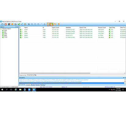
GNSS.NET
Windows – VRS Management Software
GNSS.NET is the software to combine multiple base stations as a network providing VRS service. It includes functions such as station management, user management, physical base station data transmission, VRS service, coordinate system transmission
FG for Android
Android – Field Data Collection Software
MicroSurvey FieldGenius was designed for Land Surveying, Civil Engineering, Seismic Surveying, and Construction Staking professionals to provide unequalled data collection simplicity and field calculating performance
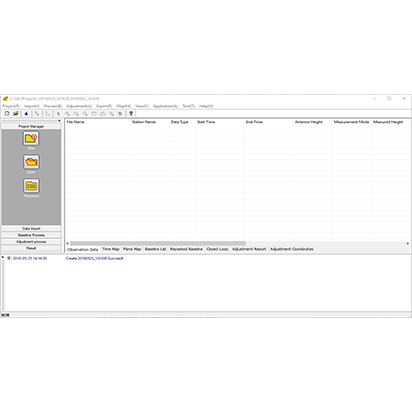
GEOSolution
Windows – Post Processing Software
GEOSolution is a software for post processing static or kinematic (also known as stop and go) data. It provides an efficient way for calculating vectors, network adjustment and resultant positions by using GPS, GLONASS, GALILEO and Beidou with single or double frequency. You can get things done easily with the compact and step-by-step interface.
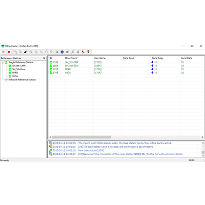
NTRIPCaster
Windows – NTRIPCaster Management Software
NTRIPCaster provides network solution for your survey job. Build your own NTRIP server to enjoy the safe and stable connection.