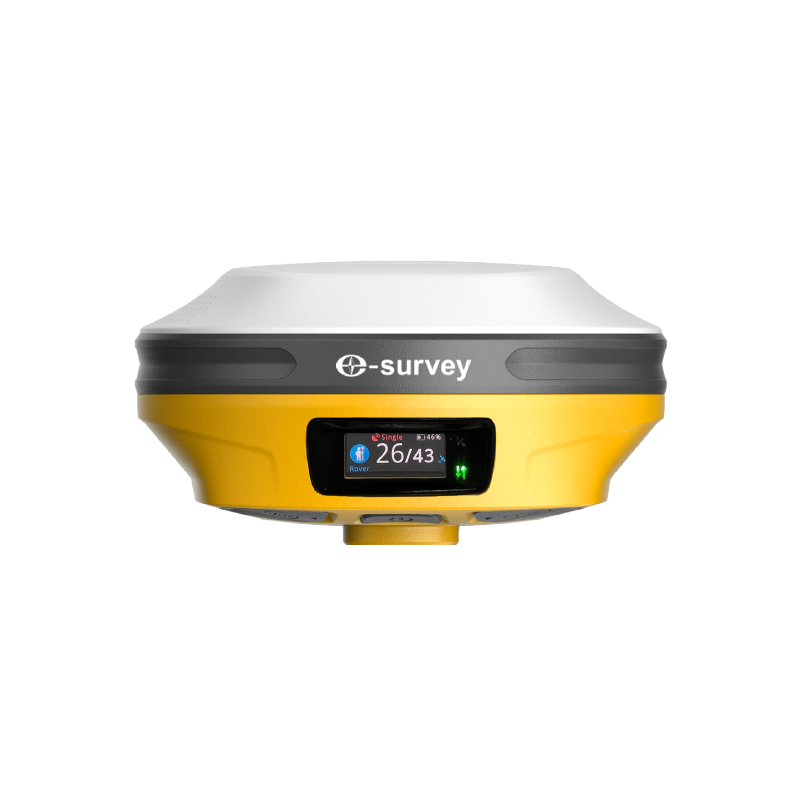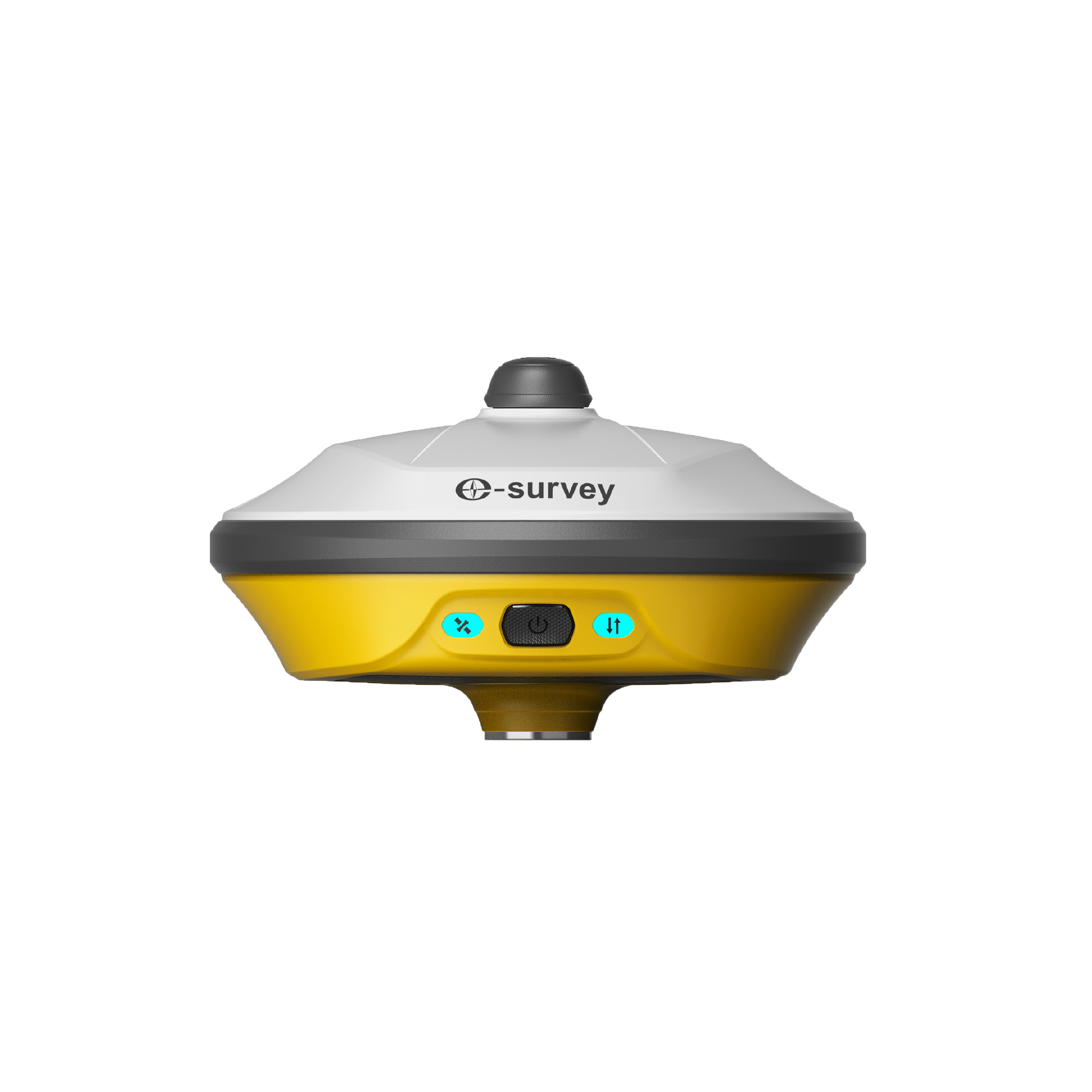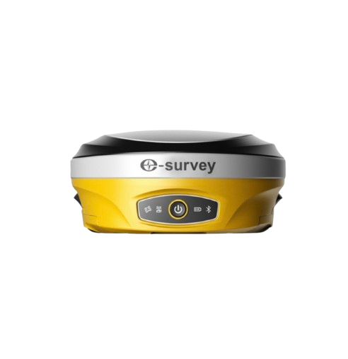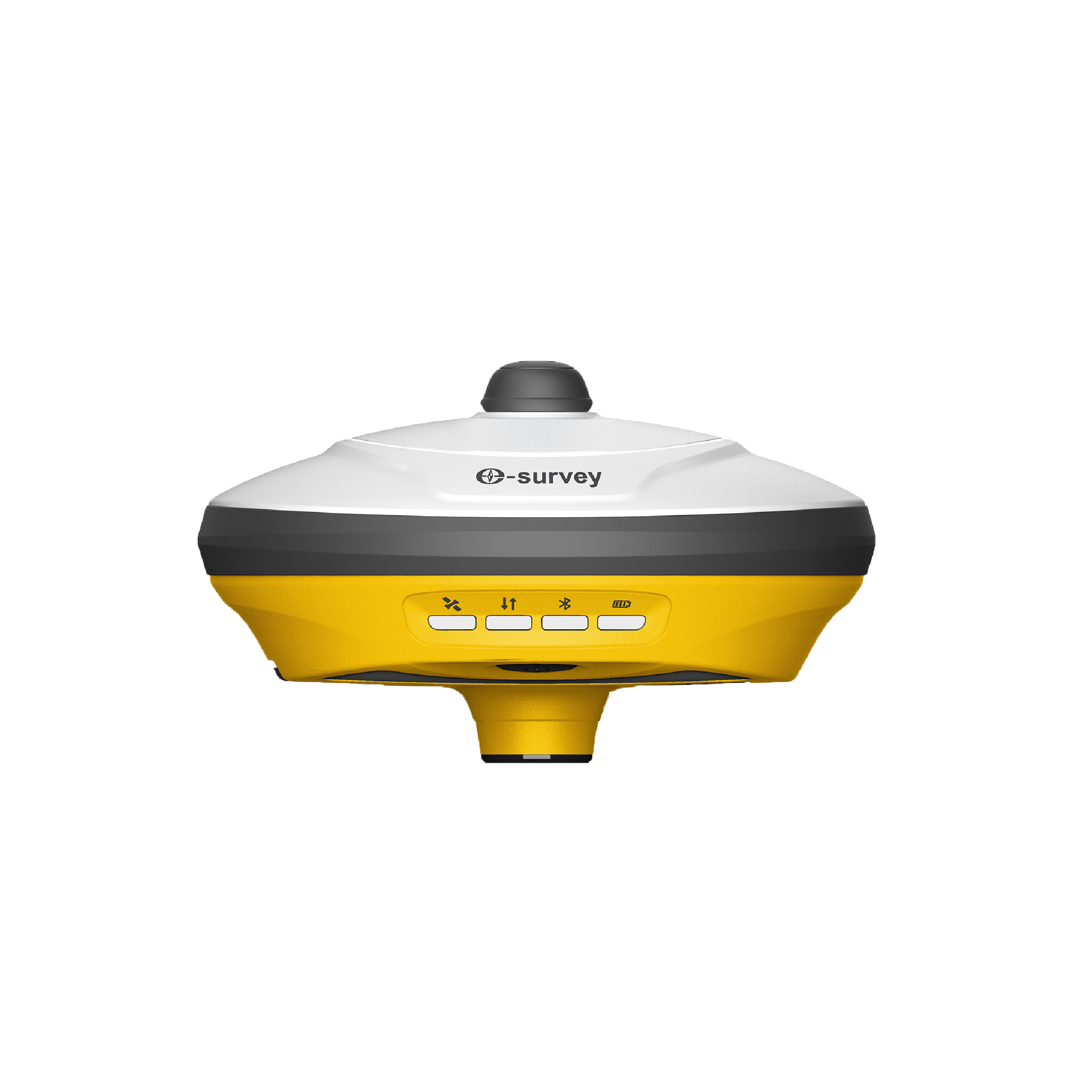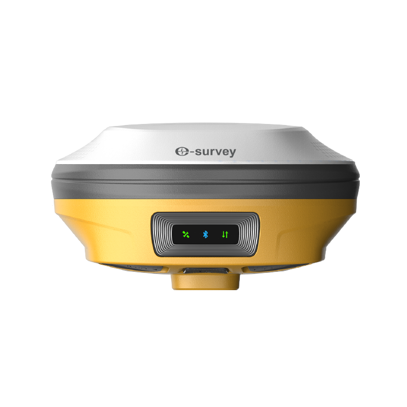
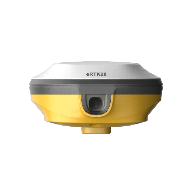

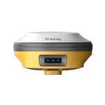
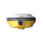
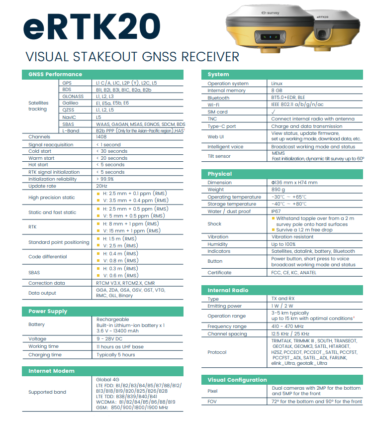
The eSurvey eRTK20 GNSS receiver combines GNSS, IMU, wide-angle dual cameras, and a compact design to dramatically improve surveying efficiency. The CAD AR visual stakeout can increase project stakeout efficiency by 40%. With inbuilt radio (Tx and Rx) and a 60° inclination IMU function, the eRTK20 is ideal for any survey scenario.
CAD AR Stakeout: Improved Efficiency
CAD drawings are directly marked on the Surpad interface, so no need to choose each point individually. The CAD AR stakeout is a highly effective tool for optimizing stakeout operations and simplifying complex construction tasks in a variety of construction scenarios. The eRTK20 improves stakeout productivity by 40% by combining
CAD base maps and augmented reality (ARy visualization
Max 60° Tilt Survey: A Different Way of Working
Accurately measure points while standing or walking without leveling the pole
Focus on where the pole tip should go, especially during stakeouts.
Conveniently conduct surveys in difficult-to-reach areas such building corners and slopes.
No need to worry about the movement of the pole when measuring, as long as it remains steady.
Multi-Constellation and Multi-Frequency
With 1408 GNSS tracking channels, it ensures robust and reliable accuracy while also being extremely resistant to multipath effects and interference. All GNSS signals come with the standard including GPS, BDS, GLONASS, Galileo, QZSS, NaviC, SBAS and L-Band
Tx/Rx UHF Modem and 4G Modem
The built-in worldwide 4G Network and Tx/Rx UHF modem enable eRTk20 to transmit GNSS corrections seamlessly regardless of the operating environment. The eRTK20 is compatible with traditional major radio protocols.
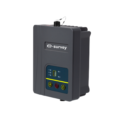
The eSurvey TRU35 is a high-power, small-size, half-duplex digital radio model, which is designed using advanced 32-bit cortex M4 micro-controller technology, wireless transceiver RF technology, and digital communication technology. It uses high-quality RF components, excellent EMC and EMI processing.
Independently designed and developed by eSurvey GNSS, the eSurvey eDMR1 features high stability, high reliability, and simple operation. It solves the problems of high cost and high deployment consumption of traditional GNSS monitoring equipment. It can be applied to monitoring the displacement and deformation of geological disasters and reservoir dams, etc., and provide all-weather high-quality monitoring results. The eDMR1 can collect data by simultaneously connecting to multiple sensors, like rainfall sensor, water level sensor, seepage, seepage pressure sensor, camera, etc., and transmit all collected data. It owns strong edge computing capability and supports local front-end static solutions. Benefiting from the built-in warning model based on multi-parameter calculation and analysis, it can realize front-end multi-parameter intelligent calculation, analysis, and warning forecast in situations, like extreme weather, no public network, etc.
The eSurvey eRTK30 GNSS receiver integrates with dual-camera technology for more applications. Its visual survey technology enables you to measure the point without physically reaching the point. That gives you flexibility in the field and maximises productivity in your projects. It supports immersive 3D stakeout and helps you do stakeout faster and improves your working efficiency. The eRTK30 is a perfect choice for diverse surveying applications.
The eSurvey eRTK10 mini is a pocket-size IMU-based GNSS receiver equipped with a high-performance and high-precision GNSS module. It integrates IMU tilt technology for efficient staking out, features a compact and lightweight design for easy portability, and serves as an ideal high-precision GNSS positioning sensor for seamless integration into various industry application solutions.
The eSurvey eRTK10 is a brand new GNSS receiver integrated with visual technology by eSurvey GNSS. It supports immersive 3D stakeout under real working environment. With the AR visual positioning technology, the eRTK10 helps you do stakeout faster and improves your working efficiency. The compact design makes it easy to carry around in various complex environments. Integrated with internal radio (Rx only) and 60° inclination IMU function, the eRTK10 is a perfect choice for any rover station scenarios.
The E600 is an innovative product from eSurvey GNSS. Its rugged IP67 design enables operation in a variety of environments. Multi-star constellation and frequency tracking provide a stable solution for your work. Thanks to its dual, swappable batteries, it can operate continuously for all-day operation.
The eSurvey UA91 adopts a high-gain broadband antenna to receive GNSS signals such as GPS, BDS, GLONASS, Galileo, IRNSS, QZSS, and L-Band. The scheme of multi-stage 3D choke coils with a symmetrical distribution is adopted to achieve higher phase center stability and excellent anti-multipath interference performance. It has excellent performance and the phase center coincides with the mechanical center.
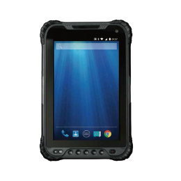
The UT32 is an 8-inch tablet with Full HD resolution (1280 x 800 pixels). The screen is also bright and colorful, making it easier for you to work. As far as internal performance goes, this is an excellently fast tablet; you can expect plenty of speed and fewer frozen apps thanks to the tablet’s 2.2GHz octa-core processor. Thanks to its impressive 8200 mAh rechargeable battery, the device can operate for 6 hours on a single charge. The UT32 is a superb rugged tablet option for anyone looking for portable, easy-to-use tablets.
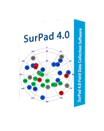
Powerful Functions Enjoy the powerful functions, including tilt survey, CAD, line stakeout, road stakeout, GIS data collection, COGO calculation, QR code scanning, FTP transmission, etc. Abundant Formats for Importing and Exporting Directly import and export files with frequently used formats and customized formats. Easy-to-use UI Freely choose the desired display style, including list, grid, and customized style, and enjoy easy operations with graphic interaction, including COGO calculation, QR code scanning, FTP transmission, etc. Advanced Display of Base Maps Supports the import of different formats of base maps including, but not limited to AutoCAD formats (DXF, DWG), SHP and Land XML, which provides a more user-friendly experience during fieldwork. Compatible with Any Android Devices Use it on all Android devices (Android 7.0 and above), including eSurvey handhelds, Android phones, tablets, and other third-party Android devices. Powerful CAD Function

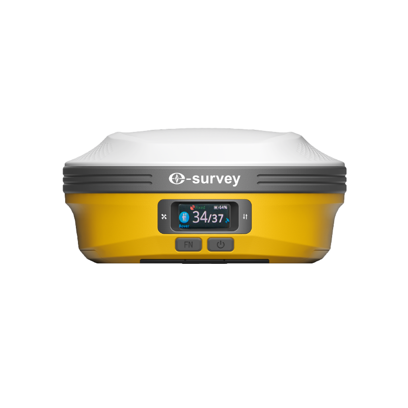
The eSurvey new eRTK60 GNSS receiver integrates high performance GNSS, IMU and dual-camera technologies to provide more reliable and diverse measurement results. Visual survey technology enables you to measure the point without physically reaching it, thereby giving you more flexibility in the field and maximizing productivity in your projects. The upgraded built-in radio supports longer communication distances. The extended working endurance of the eRTK60 is guaranteed by its hot-swap batteries. Its colorful LED screen also offers a more intuitive working status and operation interface.
Simple and powerful post-processing software, owning many preset coordinate systems and advanced data processing algorithms to process static data and obtain reliable results quickly.
The eSurvey eBase 20 is a professional and portable GNSS base receiver. With a high-precision GNSS module and tracking multiple frequencies, eBase 20 is specifically designed to work as a GNSS base station. Combining a 4G modem and internal radio, eBase 20 is a perfect choice for a base station. The eSurvey eBase 20 is ideal for applications such as UAV, USV, agriculture, intelligent driving, surveying and mapping, etc.