
-
E3
SIMPLE OPERATION TOTAL STATION
The eSurvey E3 is a high-precision manual total station, with accurate angle and distance measurement. It works reliably and delivers precise results even in harsh environments. And its simple operations make most survey and stakeout tasks more efficiently.
-
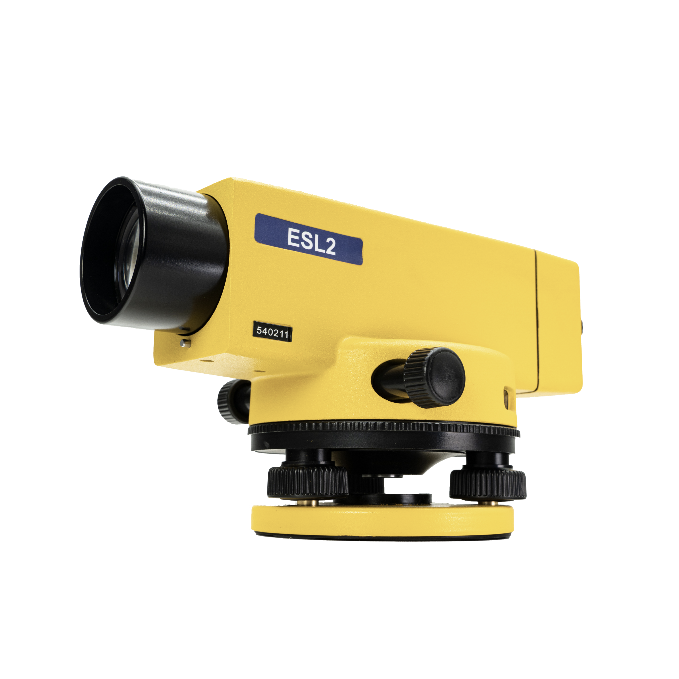
ESL2
PRECISE AUTOMATIC LEVEL
The eSurvey ESL2 is suitable for geodetic control, construction of roads, and industrial applications. The ESL2 with ESM1 can supply higher accuracy and work to monitor structural deformations. The use of an automatic compensator speeds up work and improves accuracy. ESL2 operates in the range of temperatures from -30°C to +50°C.
-
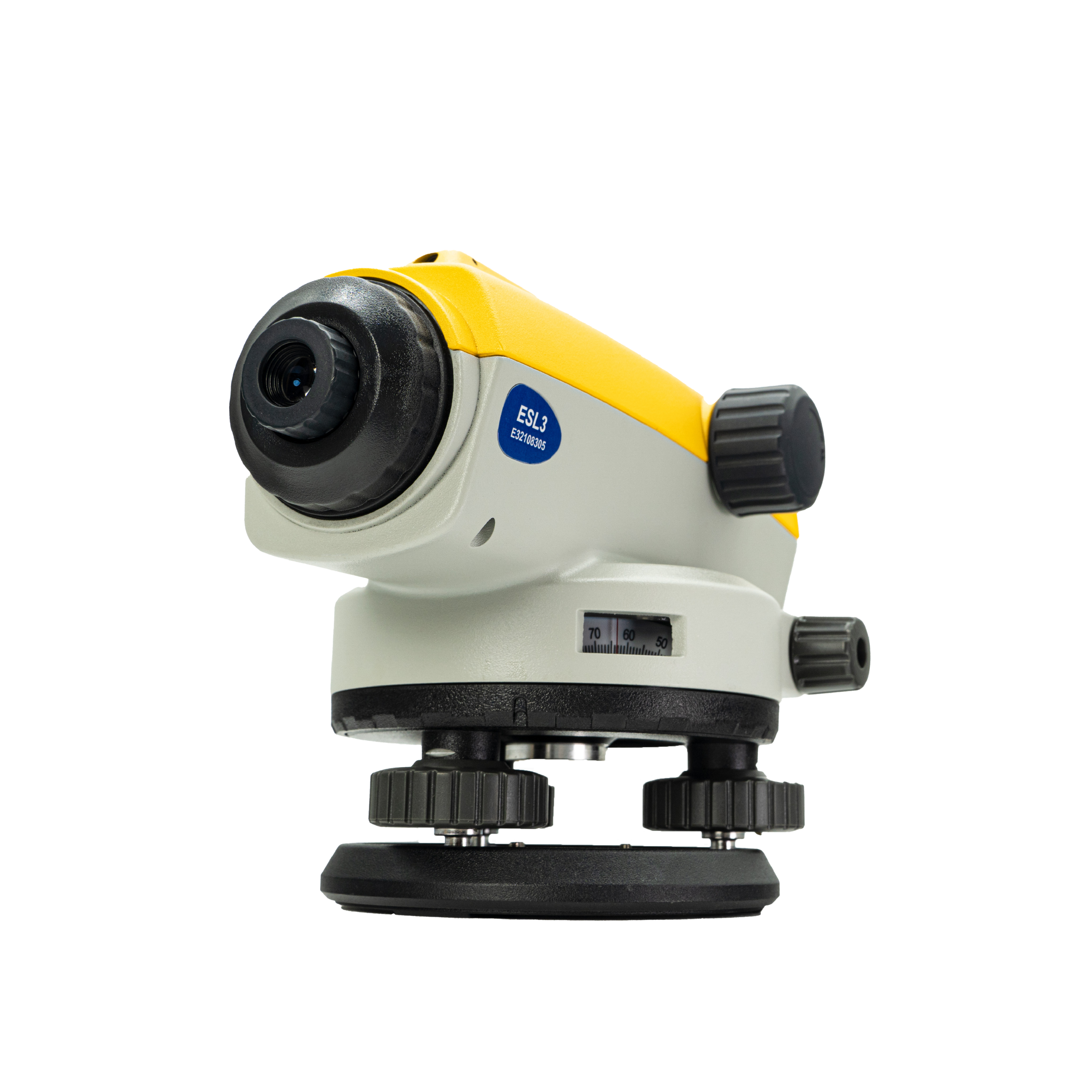
ESL3
AUTO LEVEL
The ESL3 is equipped with a magnetic damping compensation system which has a large compensation range and a high compensation accuracy compensator to ensure the equipment accuracy and measurement efficiency even in a complex environment subject to vibration or shock. 32x magnification, 38mm large clear aperture equipped with 550nm coating ensuring fast and smooth measurement. The all-metal body and IP66 design ensure the ESL3’s strong environmental adaptability.
-
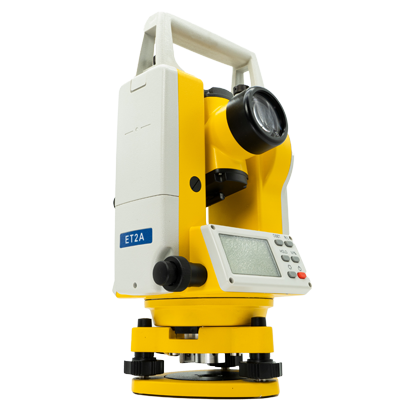
ET2A
PRECISE ELECTRONIC THEODOLITE
The ET2A is a high-precision electronic theodolite. This device has 2″ angle measurement accuracy and a 30x magnification effect to meet various working requirements.
-
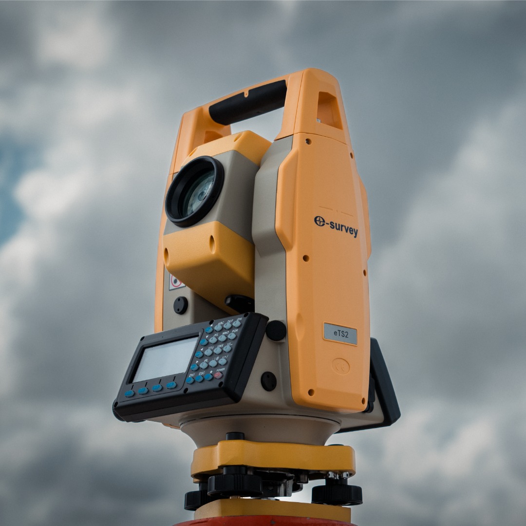
eTS2
HIGH-EFFICIENCY OPERATION TOTAL STATION
The eSurvey eTS2 is a high-precision manual total station with a better measurement range. The eTS2 can import and export data through a USB disk more efficiently, thanks to its standard USB flash disk interface. With a complete design, ensure efficient measurement.
-
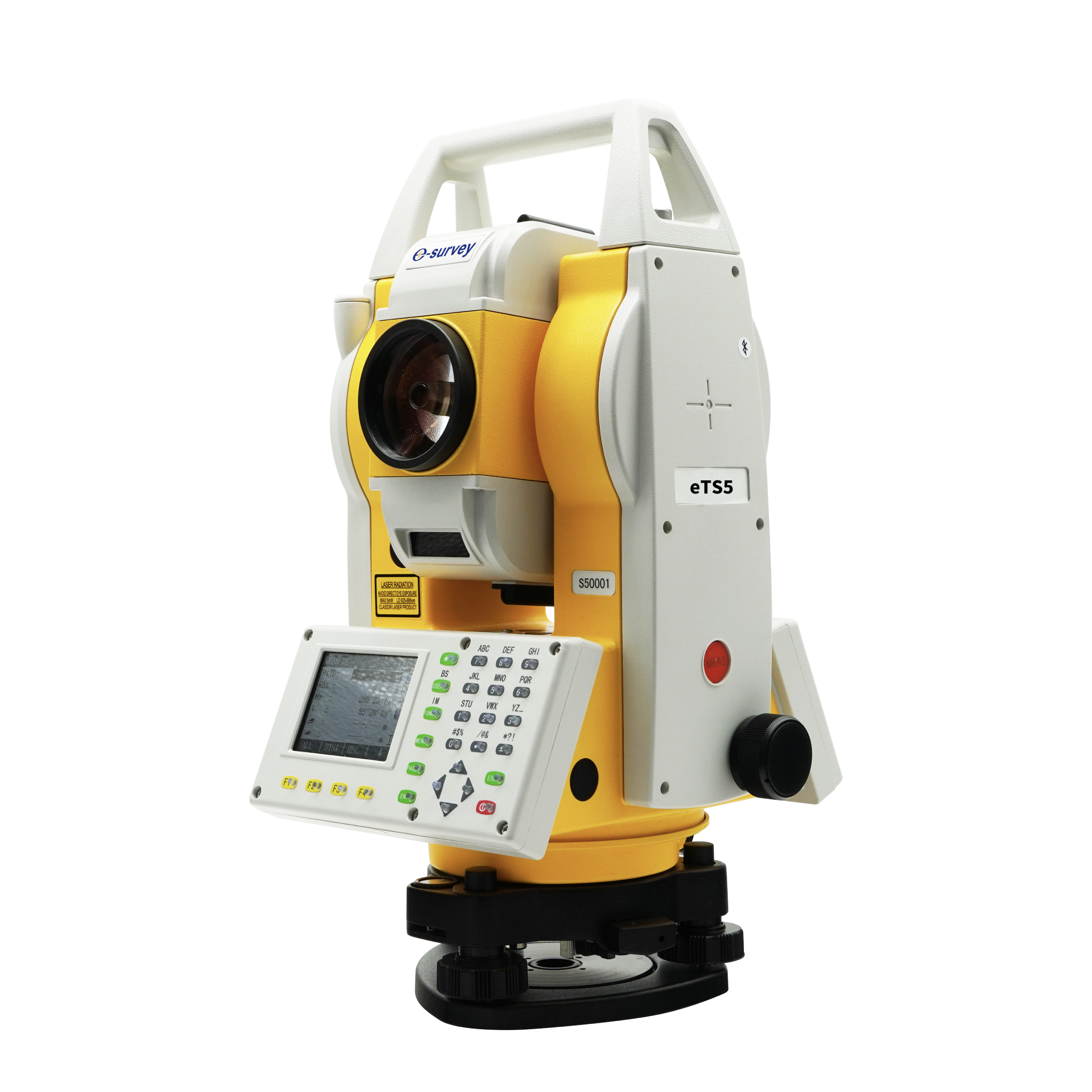
eTS5
HIGH PRECISE TOTAL STATION
The eSurvey eTS5 is a high-precision manual total station, with 2″ angle measurement accuracy that meets most survey and stakeout tasks. With Dual QVGA color screens and friction screws, the USB interface makes measurement more efficient. The 3400 mAh battery works continuously for long hours. LED-backlight alphanumerical keyboard makes it possible to operate correctly in the dark.
-
eTS8
ANDROID SMART TOTAL STATION
The eSurvey eTS8 is a high precision manual total station, with accurate angle and distance measurement. It can work reliably and deliver good results even in harsh environments. And its simple operations make most survey and stakeout tasks more efficiently.